Katla Geopark Adventures
Katla Geopark, located in southern Iceland, is a stunning natural area defined by its volcanic landscapes and diverse geological features, offering ample opportunities for outdoor adventure.
About Katla Geopark
Katla Geopark spans approximately 5,000 square kilometers in Iceland's southern region, encompassing areas from the black sand beaches of the coastline to the towering volcanic mountains inland. Named after the notoriously active Katla volcano, this geopark is filled with prominent geological wonders such as lava fields, geysers, glaciers, and waterfall-laden river canyons. Its glacial rivers hold substantial influence over the region's topography. Historically, Katla is intertwined with Icelandic culture and lore, offering unique insights into both natural and cultural history. Recreational activities abound, with hiking becoming a popular choice for visitors due to the breathtaking trails that wind through icy glaciers and jagged lava fields. Kjós, located near the infamous Eyjafjallajökull volcano, illustrates this stark beauty with its scenic hiking routes. Notable landmarks include the majestic Skógafoss waterfall and the Solheimajökull glacier. Visitors are captivated by the diversity of experiences offered by the intense green moss-covered lava fields, contrasting with the stark black sands and the icy blues of the glaciers.
Highlights
Skógafoss Waterfall
Solheimajökull Glacier
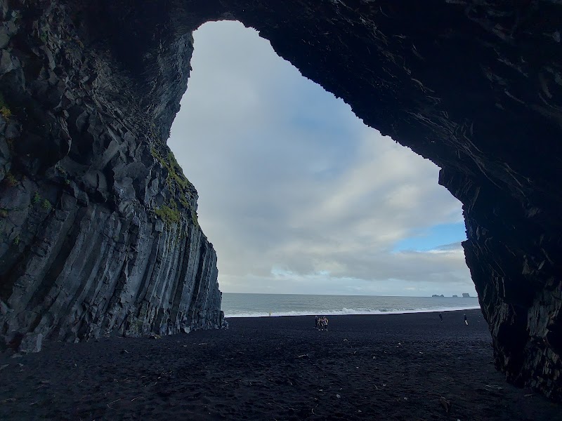
Reynisfjara Black Sand Beach
Þakgil Campground Trail
Notable Natural Features
Skógafoss Waterfall
One of the largest waterfalls in Iceland, known for its impressive drop and stunning rainbows created by its mist.
Fjaðrárgljúfur Canyon
A picturesque serpentine river canyon formed during the Ice Age, offering dramatic views and hiking paths.
Katla Volcano
An active volcano shaping the surrounding landscapes, central to the katla geopark's geology.